


Karakoram Range Guide: Location, Peaks, Glaciers, Passes, Valleys & Treks
The Karakoram Range is a major mountain system in Central and South Asia, stretching approximately 500 km (310 miles) along the borders of Pakistan, India, and China. It is home to K2, the second-highest mountain on Earth, along with three other 8,000m peaks, some of the longest glaciers outside the polar regions, and a network of valleys and high passes that have drawn explorers and trekkers for over a century. This guide covers everything you need to know about the range its location, geology, peaks, glaciers, passes, valleys, and the best ways to experience it on the ground.
What Is the Karakoram Range?
The Karakoram is one of the world’s most prominent mountain systems, recognized for having the highest concentration of very high peaks found anywhere on the planet. The name “Karakoram” comes from a Turkic term meaning “black gravel,” originally used by Central Asian traders to describe the Karakoram Pass before it was applied to the entire range.
The Karakoram contains eighteen summits higher than 7,500 m, four of which exceed 8,000 m. These four eight-thousanders are K2, Gasherbrum I, Broad Peak, and Gasherbrum II. The range covers roughly 207,000 sq km (80,000 sq miles) and has an average elevation of about 6,100 m (20,000 ft) a height that in most other mountain systems would itself count as a major summit.
Where Is the Karakoram Range Located?
The Karakoram Range is located in Central and South Asia, spanning the borders of Pakistan, India, and China. The bulk of the range lies in the Gilgit-Baltistan region of Pakistan-administered Kashmir, with its eastern extent reaching into Ladakh, India, and its northeastern edge touching Xinjiang, China. The range’s northwestern extension also brushes the borders of Afghanistan and Tajikistan, making it a geopolitically significant zone where five countries’ frontiers converge.
Within Pakistan specifically, the Karakoram runs through the districts of Gilgit, Skardu, Shigar, Ghanche, and Hunza-Nagar the same region that serves as the gateway for most international trekking and climbing expeditions.
How Was the Karakoram Range Formed?
The Karakoram was formed by the same tectonic collision that created the Himalayas: the ongoing convergence of the Indian and Eurasian plates, which began roughly 50 million years ago and continues today. This sustained compression pushed the Indian plate beneath the Eurasian plate, buckling and uplifting the crust into some of the highest terrain on Earth. Because this collision is still active, the Karakoram continues to rise, and the region remains seismically active a factor that contributes to its steep, unstable slopes and frequent rockfall.
Highest Peaks in the Karakoram Range
The Karakoram is dense with extreme altitude. The range contains eighteen peaks above 7,500 m and four peaks above 8,000 m, along with 570 named summits in total, according to mountaineering surveys of the region. Unlike the Himalayas, where 8,000m peaks are spread across a vast arc, the Karakoram’s giants sit in a comparatively compact cluster, mostly within Pakistan’s Baltoro Muztagh subrange.
K2,The Highest Peak in the Karakoram
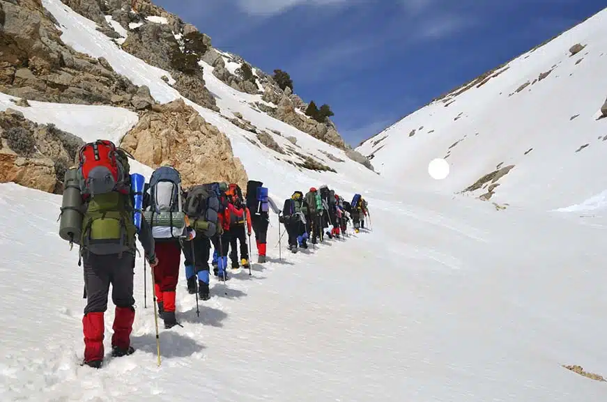
K2 is the highest peak in the Karakoram Range, standing at 8,611 meters (28,251 ft). It is the second-highest mountain in the world, surpassed only by Everest, but it is widely regarded by climbers as more technically demanding and dangerous, earning it the nickname “the Savage Mountain.” K2 is located on the China–Pakistan border within the Baltoro Muztagh subrange, and it is reached via the famous K2 Base Camp trek along the Baltoro Glacier.
Yes, K2 is in the Karakoram Range not the Himalayas. This is one of the most common points of confusion for travelers researching the region, since both ranges lie in a similar part of Asia and are sometimes discussed together.
Gasherbrum I & II

Gasherbrum I, also known as Hidden Peak, is the 11th highest mountain in the world at 8,080 m, located on the Pakistan China border between Shigar District and Xinjiang. Its neighbor, Gasherbrum II, rises to 8,035 m, making it the 13th highest peak globally. Both mountains sit deep within the Karakoram’s central massif and are typically approached via the same Baltoro Glacier route used for K2.
Broad Peak

Broad Peak reaches 8,051 m, ranking as the 12th highest mountain in the world. It sits close to K2, separated by the Godwin-Austen Glacier, and its long, wide summit ridge gives the mountain its name.
Masherbrum (K1)
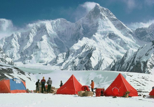
Masherbrum, originally surveyed as K1, rises to 7,821 m and dominates the skyline above the Hushe Valley. It was the first peak in the Karakoram to be designated with a “K” prefix during the Great Trigonometrical Survey, and it remains one of the range’s most photographed summits.
Trango Towers
The Trango Towers are a group of dramatic granite spires rising from the Baltoro Glacier, with the tallest formation Great Trango Tower exceeding 6,200 m. They are considered among the best big-wall rock climbing destinations in the world and are a highlight for trekkers passing through on the way to Concordia, even for those with no climbing ambitions of their own.
Major Glaciers of the Karakoram
The Karakoram has one of the highest concentrations of glaciers outside the polar regions, with nearly 2,000 glaciers covering between 28% and 50% of the range’s total area, depending on the sub-region measured. These glaciers form the highways that trekkers and climbers use to reach the range’s interior, since roads end well before base camp.
Baltoro Glacier
The Baltoro Glacier is 63 km long, making it one of the longest glaciers outside the Earth’s polar regions. It is the primary access route to K2, Broad Peak, and the Gasherbrums, and the trek along it passes through Concordia, the dramatic amphitheater where four of the world’s fourteen 8,000m peaks are visible from a single vantage point.
Biafo Glacier
The Biafo Glacier stretches 63 km, connecting with the Hispar Glacier at Hispar La to form one of the longest continuous glacier systems outside the poles a route used for the multi-week Snow Lake / Biafo-Hispar traverse.
Hispar Glacier
The Hispar Glacier runs 49 km through the Hispar Valley in Nagar, joining the Biafo Glacier at the Hispar La pass. Together, the Biafo-Hispar system forms a glacial corridor roughly 100 km long, one of the most remote and demanding trekking routes in the Karakoram.
Mountain Passes in the Karakoram
High passes connect the Karakoram’s valleys to one another and, in several cases, cross entire glacier systems. They are typically snow- and ice-covered even in summer and require proper mountaineering equipment and experienced guides.
Gondogoro La
Gondogoro La sits at roughly 5,585 m and connects the Baltoro Glacier system to the Hushe Valley. It is the classic finishing leg of the K2 Base Camp trek for parties who don’t want to retrace their steps, offering closer views of Masherbrum and Laila Peak on the descent. It is technically demanding, involving fixed ropes and glacier travel, and is generally attempted only by trekkers with a good level of fitness and prior high-altitude experience.
Hispar La
Hispar La, at approximately 5,151 m, links the Hispar and Biafo glaciers and marks the midpoint of the Snow Lake traverse. Crossing it requires several consecutive days of glacier travel with no villages or resupply points along the way.
Famous Valleys of the Karakoram
The valleys of the Karakoram serve as the last inhabited stretches before trekkers and climbers move onto glacier terrain. Each has its own character, culture, and role in expedition logistics.
Shigar Valley
Shigar Valley, northeast of Skardu, is known for its fertile terraces, apricot orchards, and the restored Shigar Fort. It serves as a staging point for expeditions heading toward the Baltoro Glacier via Askole.
Hushe Valley
Hushe Valley, in Ghanche District, is the gateway to Masherbrum, Laila Peak, and the Gondogoro La crossing. Its final village, Hushe, is typically the last point with mobile signal and permanent settlement before trekkers move into high glacier terrain.
Khaplu Valley
Khaplu Valley, also in Ghanche District, is home to the historic Khaplu Palace and serves as an alternative, less-trafficked gateway into the eastern Karakoram, including approaches to the Saltoro and Siachen region.
Karakoram vs Himalayas, What’s the Difference?
The Karakoram Range is a distinct mountain system from the Himalayas, though the two are geographically adjacent and geologically related, both having formed from the same India-Eurasia plate collision. They are frequently confused because they sit in the same broader region of Asia and share a border zone near Ladakh.
Location Differences
The Himalayas form a roughly 2,400 km arc stretching across Nepal, India, Bhutan, and China, while the Karakoram is a shorter, more compact 500 km range concentrated primarily in Pakistan, with extensions into India and China. The two ranges meet and are sometimes considered to converge near the Karakoram-Himalaya-Hindu Kush border zone in northern Pakistan.
Peak Differences
K2, Gasherbrum I, Gasherbrum II, and Broad Peak belong to the Karakoram, while Everest, Kangchenjunga, Lhotse, Makalu, and the other Himalayan 8,000m peaks belong to the Himalayas proper. K2 is in the Karakoram, not the Himalayas a distinction worth remembering, since the two names are often used loosely in casual travel writing.
Glacier Differences
The Karakoram has a notably higher concentration of large glaciers relative to its size than the Himalayas, including the Baltoro, Biafo, Hispar, and Siachen — the latter being the second-longest glacier outside the polar regions at roughly 76 km. This dense glaciation is part of what makes Karakoram trekking so distinctive: routes follow ice for days at a stretch rather than passing through forested foothills, as is more common on many Himalayan approaches.
When Is the Best Time to Visit the Karakoram?
Timing a Karakoram trip correctly matters more than in most mountain regions, since the trekking and climbing season is short and weather windows can close quickly at altitude.
Summer Trekking (June–August)
June through August is the primary season for Karakoram trekking and expeditions. Snow has generally cleared from lower passes, glacier travel is more predictable, and river crossings while still a factor are more manageable than in early spring. This is also the main climbing season for K2, Broad Peak, and the Gasherbrums.
Autumn Treks (September–October)
September and early October offer clearer skies, cooler temperatures, and thinner crowds on popular routes like the K2 Base Camp trek. The trade-off is a shorter daylight window and a higher chance of early snowfall at high passes such as Gondogoro La, so autumn trips typically require more schedule flexibility.
How to Reach the Karakoram Range
Access to the Karakoram is almost entirely funneled through Gilgit-Baltistan, and most itineraries begin in Islamabad.
By Air: Skardu Airport
The fastest way in is a flight from Islamabad to Skardu, which takes roughly 50 minutes on clear days. Skardu Airport sits at high altitude and flights are weather-dependent, so it’s common for operators to build a buffer day into itineraries in case of cancellations.
By Road: Karakoram Highway
The Karakoram Highway (KKH) connects Islamabad to Gilgit and onward toward the Chinese border at Khunjerab Pass, a roughly 15–20 hour drive depending on stops and road conditions. It’s used as a backup route when Skardu flights are grounded, and it’s also a scenic journey in its own right, passing through Hunza and Nagar.
By Jeep: Skardu to Askole
From Skardu, expeditions bound for the Baltoro Glacier continue by jeep to Askole, the last road-connected village, a journey of roughly 6–7 hours on rough terrain. From Askole, all further travel is on foot, with porters carrying supplies to base camps deep in the glacier system.
Trekking in the Karakoram Range
The Karakoram offers some of the most dramatic and demanding trekking routes anywhere in the world, ranging from multi-week glacier traverses to shorter but still technical passes.
K2 Base Camp Trek
The K2 Base Camp trek typically runs 14–20 days round trip from Skardu, following the Baltoro Glacier past Trango Towers and through Concordia, where K2, Broad Peak, and the Gasherbrums are all visible together. It’s widely considered one of the top trekking routes in the world for the density of high peaks it passes.
Gondogoro La Trek
An extended version of the K2 Base Camp trek continues over Gondogoro La into the Hushe Valley rather than returning the way trekkers came. This adds a technical, high-altitude pass crossing to the itinerary and typically extends the trip to around 18–22 days.
Snow Lake Trek (Biafo-Hispar)
The Biafo-Hispar traverse, often called the Snow Lake trek, crosses roughly 100 km of continuous glacier via Hispar La, connecting the Braldu and Hunza-Nagar valleys. It’s a 20+ day expedition-style trek suited to experienced trekkers comfortable with sustained glacier travel and full logistical self-sufficiency.
Plan Your Karakoram Adventure with Skardu Trekkers
Whether you’re aiming for the K2 Base Camp trek, a technical crossing of Gondogoro La, or a full expedition to one of the range’s 8,000m giants, route knowledge and experienced local support make the difference between a trip that goes smoothly and one that doesn’t. Skardu Trekkers organizes treks and expeditions throughout the Karakoram, from Hushe and Shigar to the Baltoro and Biafo-Hispar glacier systems, with the permits, staff, and logistics needed to travel safely in this remote terrain.
Frequently Asked Questions
Where is the Karakoram Range located?
The Karakoram Range is located in Central and South Asia, spanning parts of Pakistan, India, and China, with its core lying in the Gilgit-Baltistan region of Pakistan.
What mountain range is K2 in?
K2 is in the Karakoram Range, on the border between Pakistan and China.
Is K2 in the Himalayas or Karakoram?
K2 is in the Karakoram, not the Himalayas. The two ranges are geographically close and geologically related but are distinct mountain systems.
What is the highest peak in the Karakoram Range?
K2, at 8,611 meters, is the highest peak in the Karakoram Range and the second-highest mountain in the world.
Is the Karakoram Range part of the Himalayas?
No. The Karakoram is a separate mountain range from the Himalayas, though the two share a border zone and were formed by the same tectonic collision between the Indian and Eurasian plates.
What is the difference between the Karakoram and Himalayan ranges?
The Karakoram is shorter (about 500 km) and more compact than the roughly 2,400 km Himalayan arc, is concentrated mainly in Pakistan, and has a denser concentration of very high peaks and large glaciers relative to its size.
Which countries does the Karakoram Range span?
The Karakoram spans Pakistan, India, and China, with its northwestern extension touching Afghanistan and Tajikistan.
When is the best time to trek in the Karakoram?
June through August is the main trekking and climbing season, with September and early October offering a clearer, quieter alternative for those able to build in extra schedule flexibility.
What are the major glaciers in the Karakoram Range?
The major glaciers include the Baltoro (63 km), Biafo (63 km), Hispar (49 km), and Siachen (76 km), among nearly 2,000 glaciers found throughout the range.
Where is the Karakoram Range on a map?
The Karakoram sits north of the Himalayas and south of the Kunlun Mountains, in the region where the borders of Pakistan, India, China, Afghanistan, and Tajikistan converge roughly centered around 36°N, 76°E.




Comments are closed